


The Chocolate Hills: What They Are and How They Formed
The Chocolate Hills look so regular they invite legends, but their real origin is geological — a remarkable tropical karst landscape shaped from limestone over an immense stretch of time.
What you’ll learn
The bigger picture before you dive in
What cone karst is and why limestone matters.
Why the hills change colour through the year.
The difference between a UNESCO Global Geopark and a World Heritage Site.
A landscape of cone karst
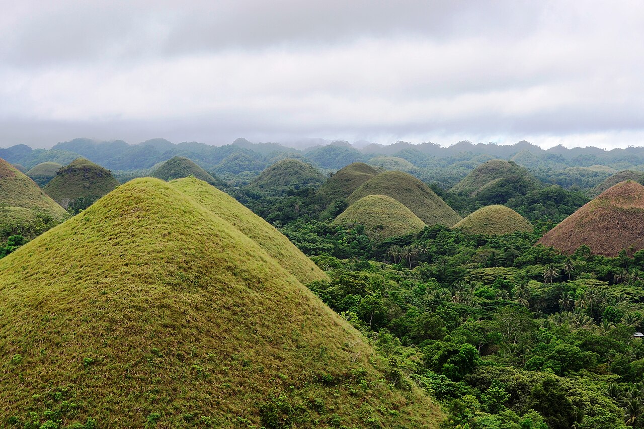
UNESCO describes Bohol’s landscape as containing extensive karst features formed in limestone. The Chocolate Hills are the best-known expression: repeated conical hills rising from the surrounding terrain.
Karst landscapes form where soluble rock, especially limestone, is gradually shaped by water. Rainwater becomes slightly acidic as it absorbs carbon dioxide and can slowly dissolve limestone along cracks and weaknesses. Over immense periods this process creates caves, sinkholes, ridges and unusual hill forms. The Chocolate Hills are part of that much larger geological story.
Why they turn “chocolate”
The hills are normally green during wetter periods. In the dry season the grass can brown, creating the colour contrast that inspired the name Chocolate Hills.
The word “Chocolate” describes appearance rather than rock type. During greener periods, grass covers the hills in fresh vegetation. In drier conditions the vegetation browns, producing the famous chocolate-coloured look seen in many photographs. The changing colour is therefore seasonal, while the shape of the hills reflects geological processes operating over far longer timescales.
Geology, biodiversity and communities together
UNESCO Global Geoparks are not just lists of beautiful rocks. The designation connects internationally important geology with education, conservation, local communities and sustainable development across the wider island.
UNESCO Global Geoparks are designed to connect geology with education, conservation and local development. They recognise landscapes where geological heritage is internationally significant and can be used to support communities and learning. That is different from the World Heritage system, which has its own criteria and inscription process.
A useful UNESCO distinction
Bohol Island is a UNESCO Global Geopark. The Chocolate Hills have also appeared on the Philippines’ World Heritage Tentative List, but that is not the same as being an inscribed UNESCO World Heritage Site.
This distinction matters because tourism descriptions often casually attach the phrase “UNESCO World Heritage Site” to famous places. Accuracy is better than hype. Bohol’s actual UNESCO Global Geopark status is already remarkable and tells a richer story about the whole island rather than just one viewpoint.
The key takeaway
The Chocolate Hills are impressive because their real geological story is more extraordinary than any invented label.
Speak like you are there
Useful Bisaya from this story
Turn the story into something you can say.
Discovering Cebuano culture makes the language memorable. Speak Bisaya connects that context to pronunciation, stories, practical phrases and structured learning.
Keep exploring
Bohol
Bohol: History, Culture and the Bisaya Language
Bohol beyond the beaches — from Boholano Cebuano and Sandugo traditions to UNESCO Global Geopark status.
Read nextRegion
The Visayas: Islands, Languages and Culture
The Visayas as a connected island world with multiple languages, strong local identities and centuries of maritime movement.
Read nextTravel
Why Learn Bisaya Before Visiting Cebu and Bohol?
How a small amount of Cebuano can transform travel in Cebu and Bohol — from markets and transport to family conversations and local hospitality.
Read next